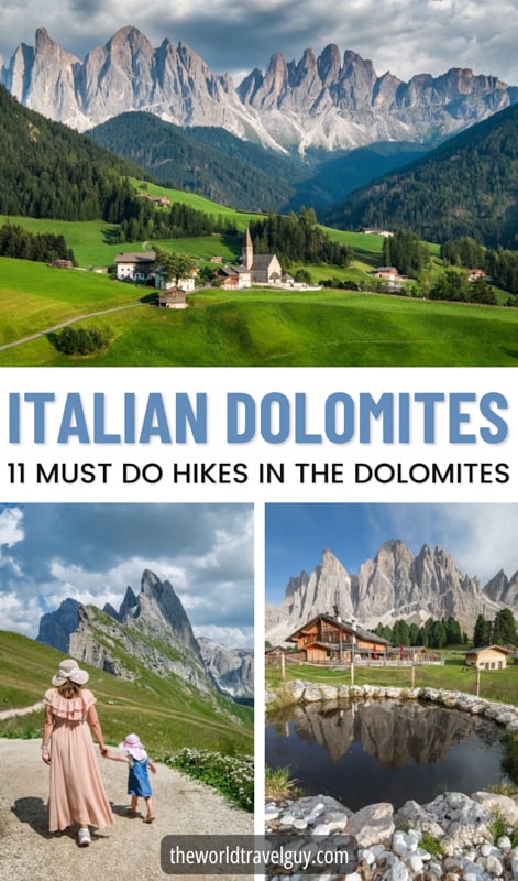
If I was making a list of the most beautiful places in the world, I’d probably put the Italian Dolomites somewhere near the top.
The landscapes are like another world, with jagged mountains, medieval churches, and turquoise lakes. It’s one of the coolest places I’ve seen.
We spent 2 weeks in the Dolomites recently, driving all over the area and hiking every single day. There are plenty of easy, family-friendly walks, but also some challenging trails and full day treks as well.
In this guide, I’ll share some must do hikes in the Dolomites, based on our experience. If there’s one I missed, feel free to share it in the comments at the end of the article!
1. Lago di Sorapis
Sorapis is a bright turquoise lake surrounded by mountains, and the color is unreal.
It’s a fairly rough hike to the lake, with lots of incline, rocky paths, and tree roots to navigate. If you’re a regular hiker who’s in good shape, I’d rate it as moderate difficulty. Otherwise, it could be hard for some people.
There are also a few narrow sections of the trail where there’s a bit of exposure, but they have metal handrails to hold, so it’s never crazy or dangerous. I felt very safe the whole time.
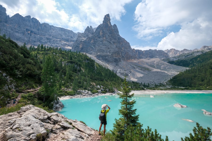
Lago di Sorapis
Unfortunately, Sorapis is a very popular hike, so it can be a bit awkward passing people going the other direction at narrow sections of the trail, and that makes it a bit slower going down on the way back.
That also means the parking fills up quickly at Passo Tre Croci, where the hike starts, so you may have to park somewhere down the hill, which will add some extra time to the hike.
Start very early if possible, so you can get a parking spot and avoid the worst crowds. Besides, morning is the best time to photograph the lake!
Distance: 12.7 kilometers (7.9 mi) roundtrip
Elevation Gain: 600 meters (1,970 ft)
Difficulty: Moderate
Map: AllTrails
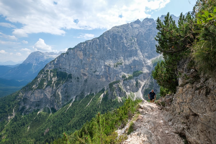
Cliff views on the way to the lake
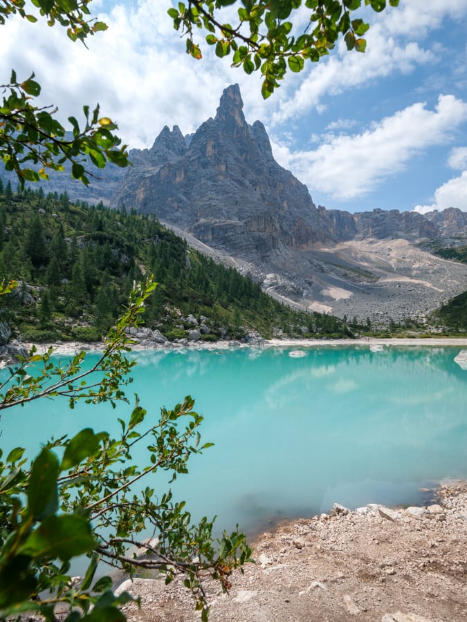
The color is so awesome
2. Tre Cime di Lavaredo
This trail loops around the ‘three peaks of Lavaredo,’ and it’s one of the most iconic hikes in the Dolomites.
The trail starts at Rifugio Auronzo, which has a big parking lot. You can go there with your vehicle, but online reservations are required and they tend to sell out in advance, so you’ll need to book early if you want a parking spot.
Another option is to take the bus from Lago di Misurina, which runs every 30 minutes in high season. You can find more info on that here.
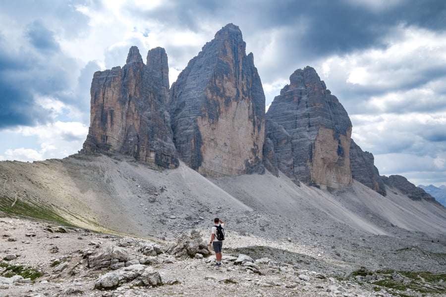
Tre Cime di Lavaredo
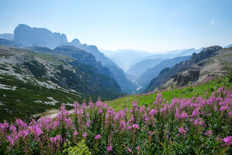
Flowers above the canyon
The main trail at Tre Cime is family friendly and doable for most people, with just the right amount of challenge.
For a longer hike, you can take an optional detour to Rifugio Antonio Locatelli and the twin lakes of Laghi dei Piani. A lot of people do that.
If you’re a photographer, don’t forget to check out the ponds near the hut at Malga Langalm. Those can be nice for capturing reflections of the three towers!
Distance: 6.9 kilometers (4.3 mi) roundtrip
Elevation Gain: 330 meters (1,085 ft)
Difficulty: Moderate
Map: AllTrails
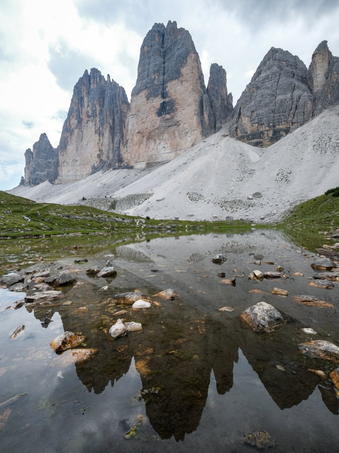
Reflection of the towers
3. Cadini di Misurina
This is another nice hike that starts from Rifugio Auronzo, in the same parking lot as Tre Cime di Lavaredo. The same entry rules apply: you need to get a parking reservation or else take the bus.
There’s plenty of time to do both hikes in the same day, if you’d like. I’d recommend doing Cadini first, since it’s shorter, and then Tre Cime afterwards.
The hike to Cadini only takes less than half an hour, but it feels longer just because it’s mostly uphill.
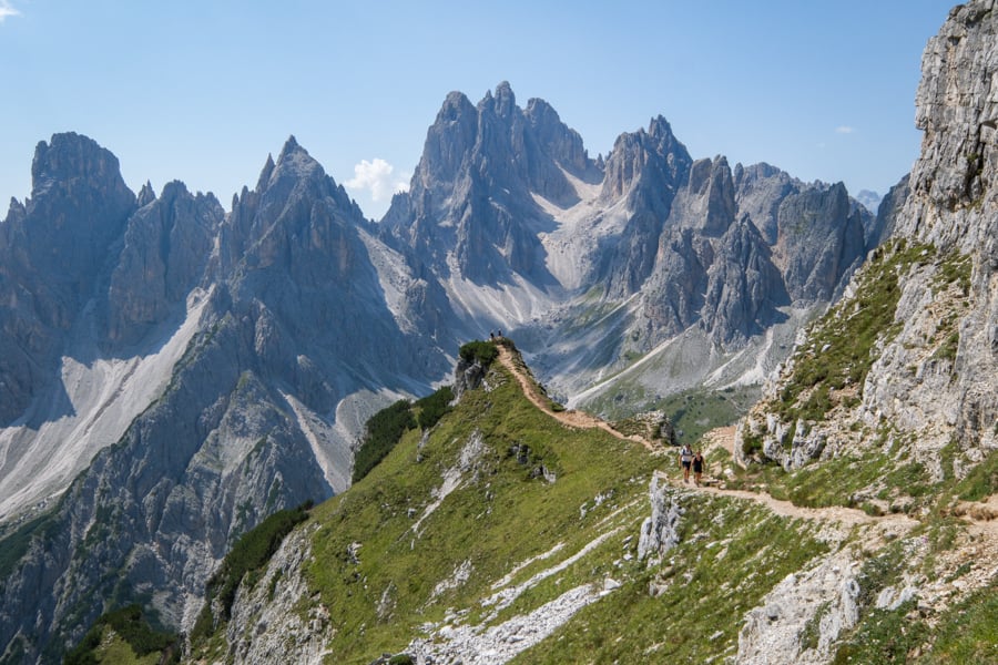
Cadini di Misurina
This hike has gotten very popular because of the amazing viewpoint. It’s like a natural platform with elevated views of the jagged mountains.
During high season, there’s usually a long line to take pictures at the main viewpoint, but thankfully you can get great panoramic views anywhere along the trail, and it’s pretty similar to what you see at the viewpoint.
This is a short hike with lots of bang for the buck!
Distance: 3.5 kilometers (2.2 mi) roundtrip
Elevation Gain: 205 meters (675 ft)
Difficulty: Easy / Moderate
Map: AllTrails
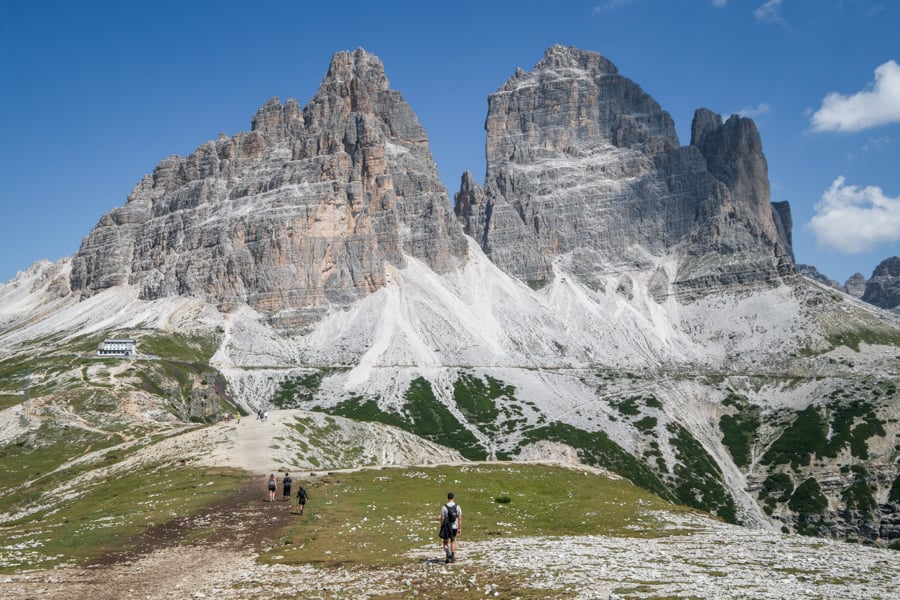
Views on the way back from the hike
4. Cinque Torri
This is a nice hike featuring ‘five towers’ (Cinque Torri), and it starts with the best view right from the get go.
It’s located not far from the town of Cortina d’Ampezzo, and it’s a very popular hike, but there’s lots of parking space and you don’t need a reservation yet, as of 2026.
You can access the trail by taking a chairlift, or you can hike up in about an hour instead. I bought my ticket for the lift in person with no issues, but you can book it online here if you prefer.
The trail at Cinque Torri loops around the towers, giving you lots of interesting views, and you can usually see climbers on the rocks as well.
Distance: 2.1 kilometers (1.3 mi) roundtrip
Elevation Gain: 120 meters (395 ft)
Difficulty: Easy
Map: AllTrails
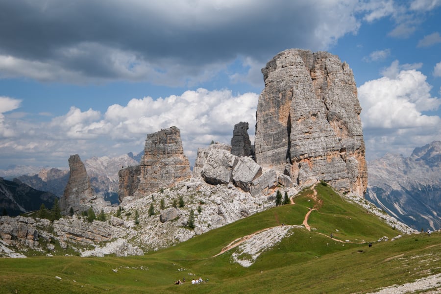
Cinque Torri
5. Adolf Munkel Trail
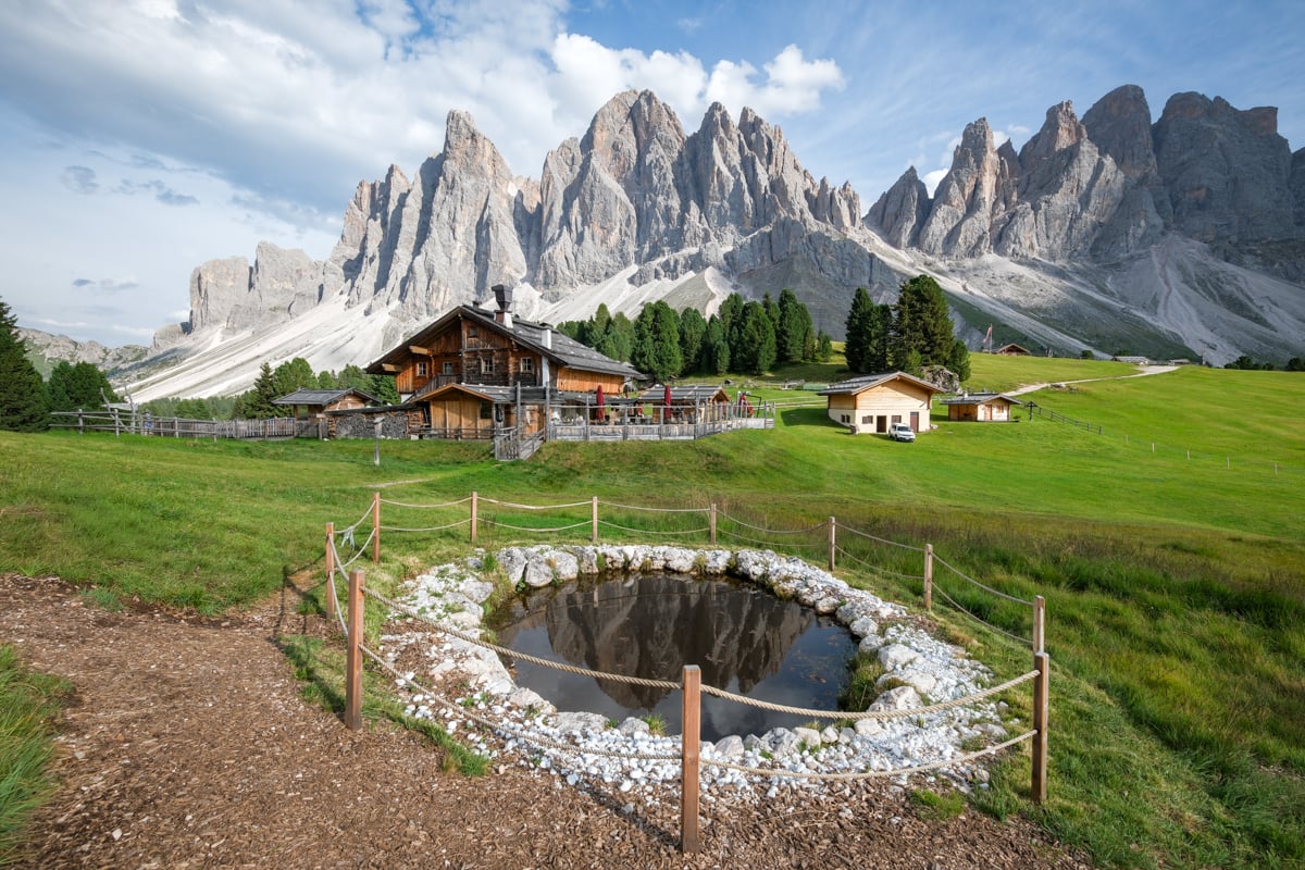
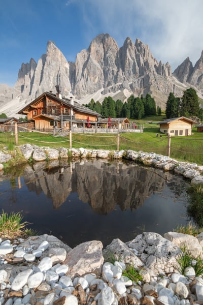
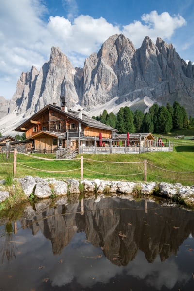
This is a spectacular hike near Val di Funes that gives you up close views of the knife-like peaks in the Odle mountain group.
Adolf Munkel is a loop trail, and most people prefer to do it in a clockwise direction, that way you’re starting with a gradual incline instead of the steepest parts. I did it counterclockwise and that worked fine too.
The very best views are at Rifugio Odle / Geisler Alm, which sits directly in front of the mountains. You can get food or recline on a chair while soaking up the scenery.
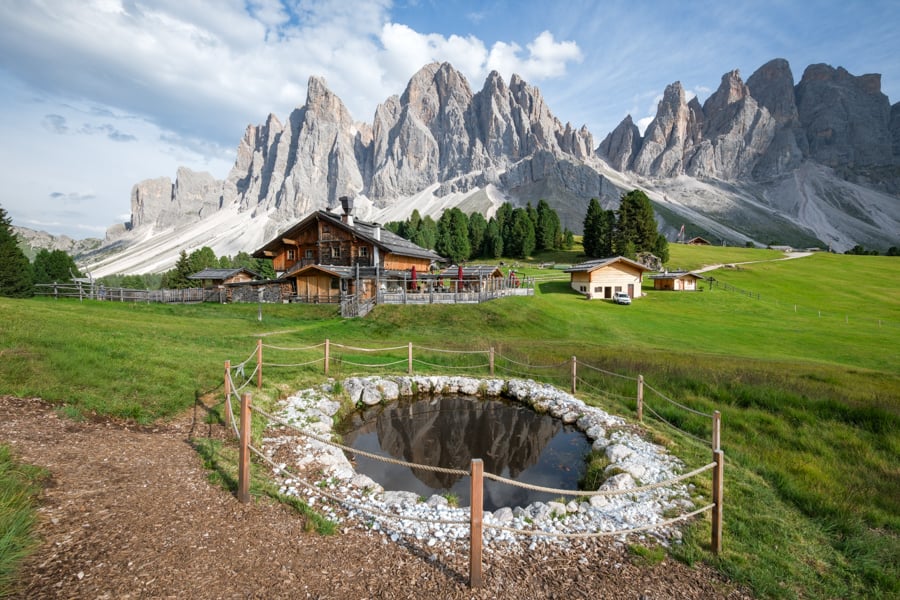
Adolf Munkel trail
The trail starts at the Zanser Alm parking lot, which is generally reserved for people with online bookings unless you get there very early or late in the day.
I’d recommend starting later in the afternoon, when the mountains are in full sun. That’s when my photos were taken. If you go earlier in the day, it’s backlit and doesn’t look the same.
I went at around 4 PM in high season, and not only did I easily get a parking space, but the crowds were also thinning out and I had the trail mostly to myself!
Distance: 9.7 kilometers (6 mi) roundtrip
Elevation Gain: 465 meters (1,525 ft)
Difficulty: Moderate
Map: AllTrails
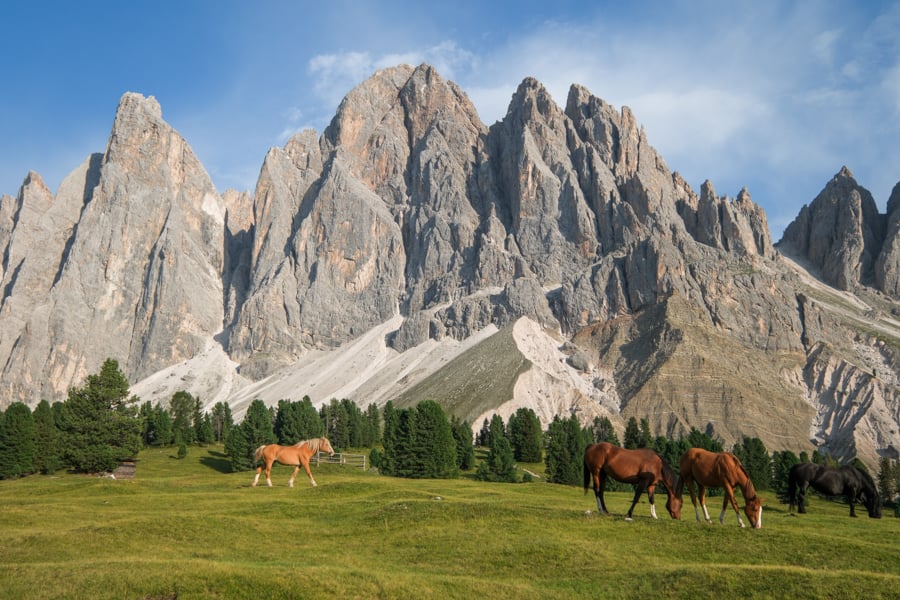
Horse ranch near Geisler Alm
6. Puez-Odle Trek
This is the longest hike I did in the Dolomites, but it was worth it. People normally take 6-8 hours to finish the trek, so plan to spend most of the day on it.
The Puez-Odle trail has a wide variety of scenery, including multiple lakes and a moon-like valley of pointy rocks that reminded me of something from Star Wars.
Near the halfway point, there’s the Rifugio Puez, a mountain hut where you can sit down, rest, and order food.
The last part of the trail descends through Vallunga, a green valley with an old chapel and other sights.
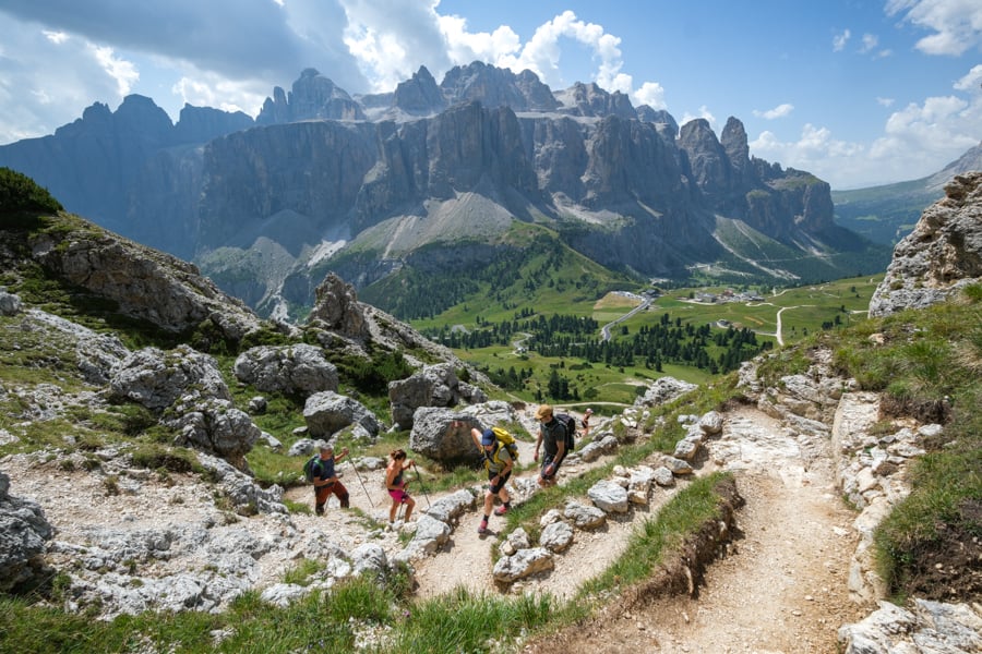
Puez-Odle trek
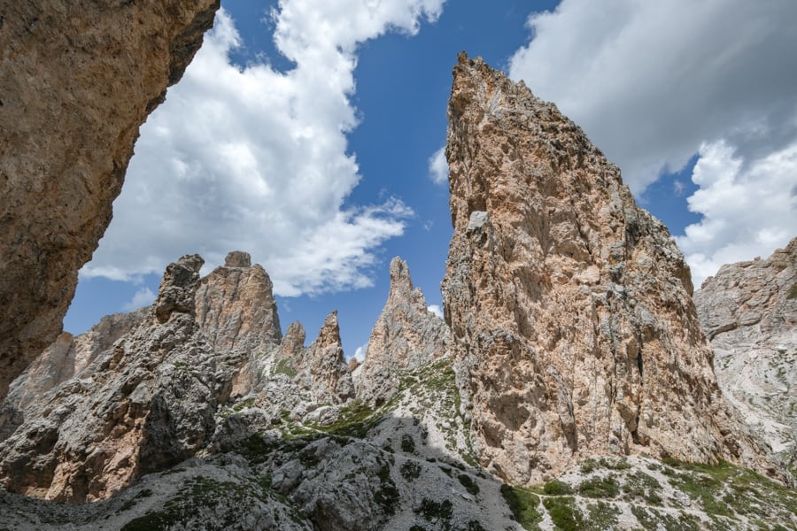
Valley of pointy rocks
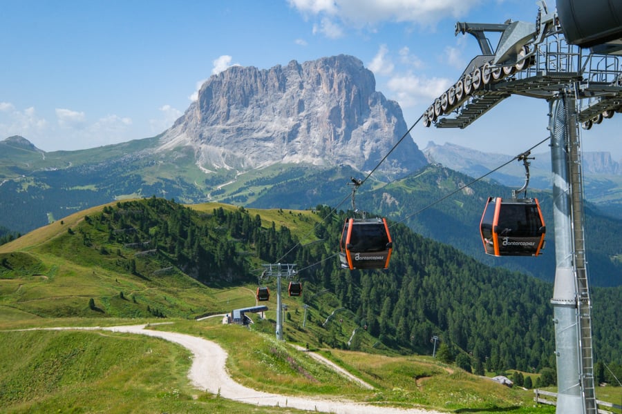
Dantercepies cable car
You start the Puez-Odle trek by taking the Dantercepies cable car in Selva di Val Gardena up to Passo Gardena.
As of 2026, no advance reservation is needed for the cable car, but you can find prices and timetables on their website here.
You only need to buy a one way ticket for the cable car, because Puez-Odle is a point to point hike that takes you back to the lower cable car station in Selva di Val Gardena, where you started.
Puez-Odle is already a long hike, but if you want to make it even longer, you can take a detour to the peak of Sass da Ciampac. Either way, this is one of the most interesting hikes in the Dolomites, so it’s worth the experience!
Distance: 15.4 kilometers (9.6 mi) point to point
Elevation Gain: 640 meters (2,100 ft)
Difficulty: Moderate / Hard
Map: AllTrails
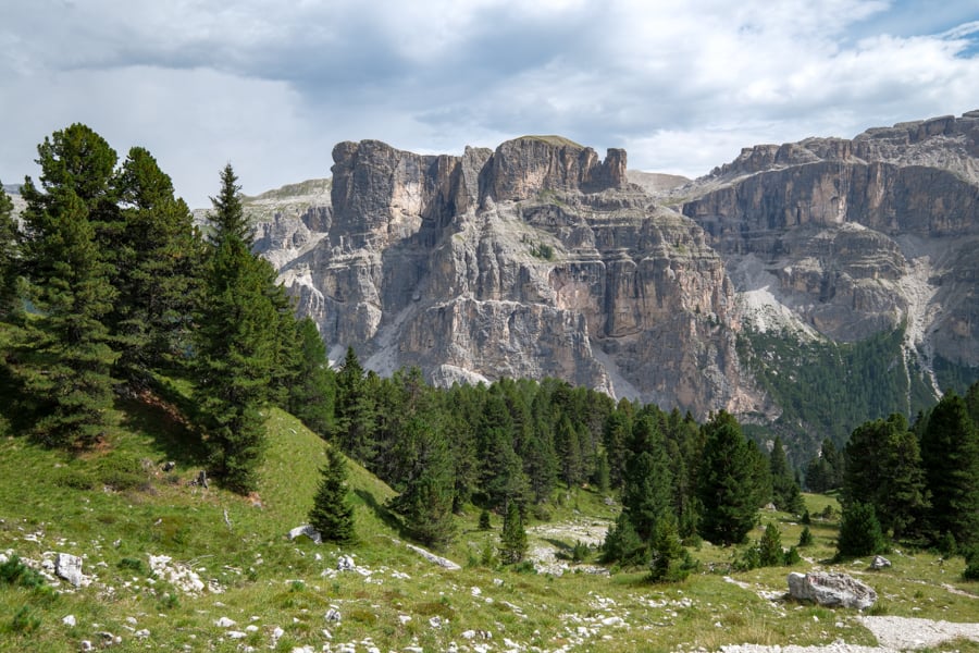
Descending into Vallunga
7. Seceda
Seceda is one of the most incredible things I’ve seen. It looks like a different planet!
This epic ridge is normally accessed by cable car from Ortisei, and it’s crazy expensive compared to other cable cars in the Dolomites. It’s still worth it though, because the views at Seceda are out of this world.
You can check the current prices and timetable for the Ortisei cable car here. An advance booking is recommended. There’s also a cable car from Col Raiser, but it doesn’t take you quite as far up the ridge.
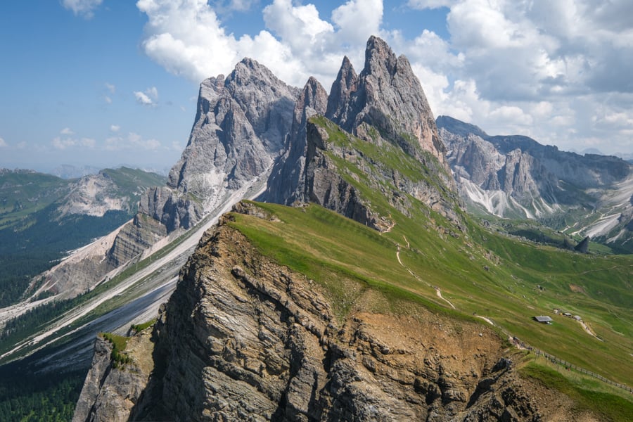
Seceda ridge
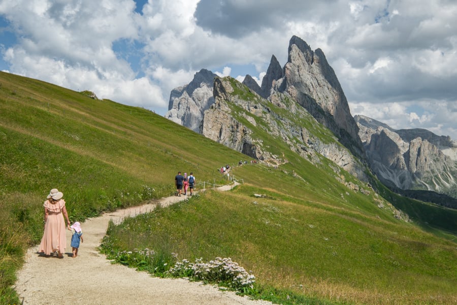
Walking path at Seceda
If you don’t want to pay for the cable car, another option is to hike up to Seceda from Ortisei, but that takes about 4-5 hours one way, and it’s a hard hike with a ton of elevation gain. Most people use the cable car for that reason.
Once you reach the top of the ridge, you can see the main view of Seceda with just a short walk, but it’s worth hiking further to the Pieralongia Hut for even more sights. You can also grab lunch at the hut while you’re there.
Seceda is a very family friendly experience, and anyone going to the Dolomites should see it. Yes, it’s crowded, but it’s worth it!
Distance: 5.5 kilometers (3.4 mi) roundtrip
Elevation Gain: 320 meters (1,050 ft)
Difficulty: Easy / Moderate
Map: AllTrails
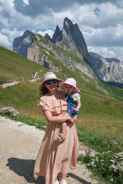
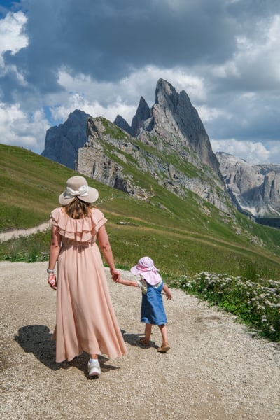
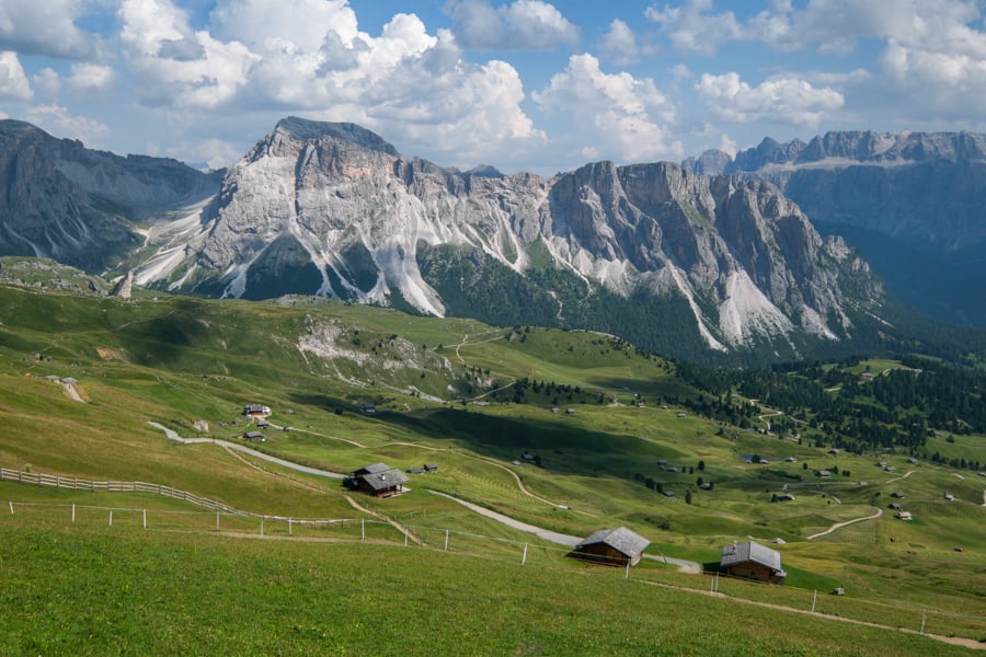
Views down the hill
8. Santa Maddalena Viewpoint
My favorite thing we saw in the Dolomites might be the view of Santa Maddalena church with the mountains in the background. It’s stunning.
In the past, you could drive up to the viewpoint, but unfortunately it got too crowded and they had to block the traffic for anyone except locals or people staying in hotels there.
That means you now have to do some hiking to reach it.
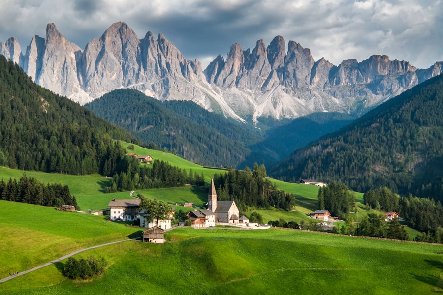
Santa Maddalena viewpoint
It’s a short hike that’s mostly on paved roads, and only takes about half an hour each way, but it’s all uphill, so that makes it tougher than you’d expect.
Unless you’re staying at a hotel in Santa Magdalena, you’ll have to make use of the paid parking in the center of the town, and start the hike from there.
Don’t bother coming earlier in the day, because the mountains are completely backlit at that time, and parking is tied up by people doing other hikes.
It’s better to do this one in the evening or at sunset, when the lighting is perfect!
Distance: 3.6 kilometers (2.2 mi) roundtrip
Elevation Gain: 150 meters (490 ft)
Difficulty: Easy / Moderate
Map: AllTrails
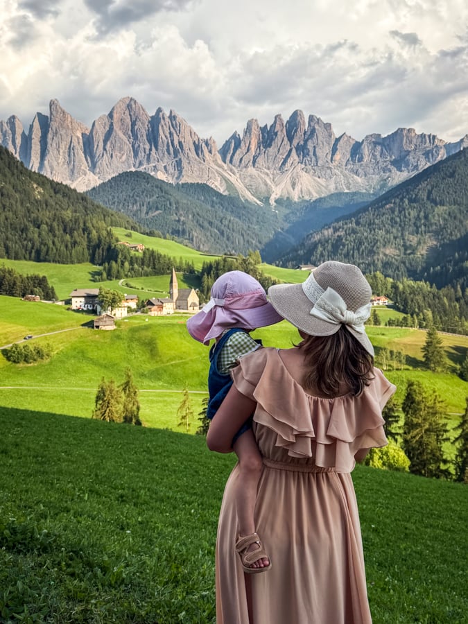
Wonderful view at Santa Maddalena!
9. Peitlerkofel Hike
This is another family friendly hike with some impressive mountain peaks: the Peitlerkofel, also known as Sass de Putia, and its smaller brother, Kleiner Peitlerkofel.
Most people only hike until they reach the hut at Fornella Alm, which has a restaurant and a nice playground for kids. From the parking lot in Wurzjoch, you can reach Fornella in only 15 minutes of walking.
We turned around at Fornella because we had our baby girl with us, and didn’t have time to finish the whole trail. She loved the playground though, and there was lots of room for her to run around and explore.
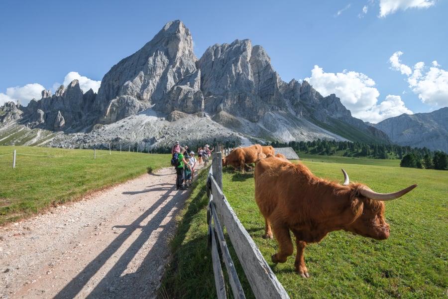
Cattle at Peitlerkofel
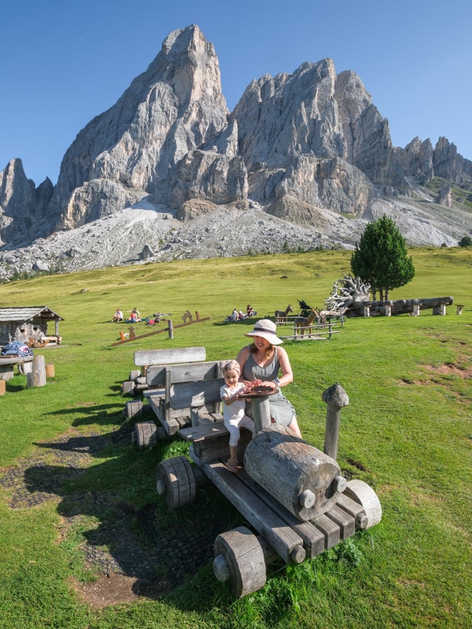
Playground fun at Fornella Alm
From there, you can make it a longer hike by following the loop trail that circles the mountains, or if you really want to make the hike more challenging, you can climb the two mountain summits.
Kleiner Peitlerkofel is fairly straightforward, but the main summit of Peitlerkofel isn’t recommended without mountaineering experience.
The stats below are just for the short hike to Fornella Alm and back, because that’s how most families hike this trail.
Peitlerkofel is backlit in the morning, so I’d highly recommend going in the late afternoon or evening. The lighting is much better on the mountains, and the crazy crowds are starting to thin out at that time.
Distance: 2.4 kilometers (1.5 mi) roundtrip
Elevation Gain: 70 meters (230 ft)
Difficulty: Easy
Map: AllTrails
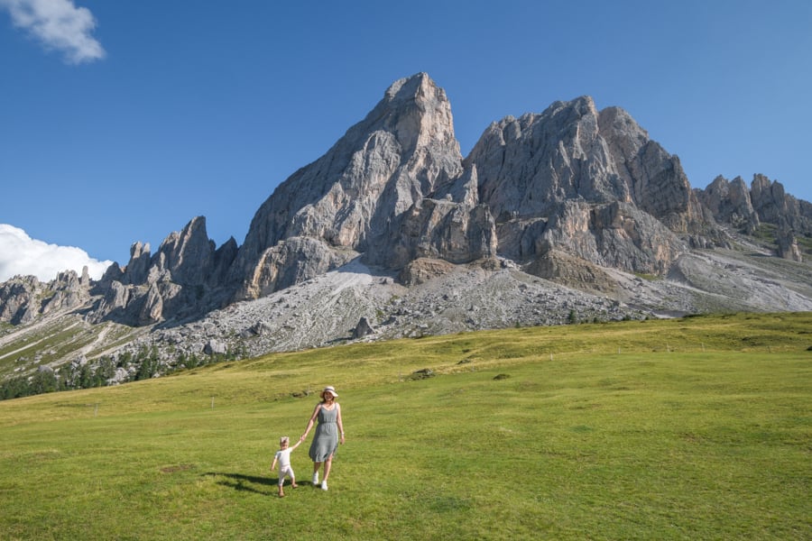
Free as a bee!
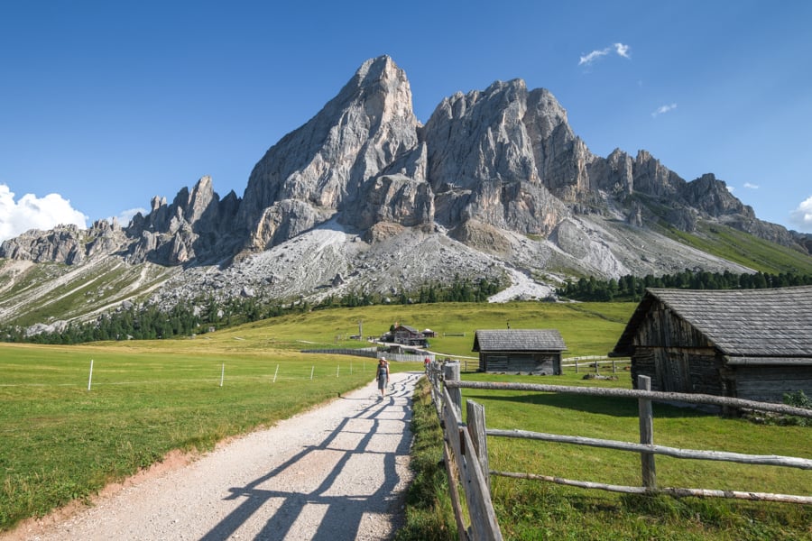
Mountain ranches at Peitlerkofel
10. Lago di Lagazuoi
This trail mainly seems to be popular with locals instead of international tourists, but I think it’s one of the best hikes in the Dolomites.
It’s a fairly short hike that ends with a green lake surrounded by mountains. It may not be the most impressive lake in Italy, but it’s still pretty nice.
It’s also one of the only lakes in the Dolomites that allows swimming, so that’s a nice bonus.
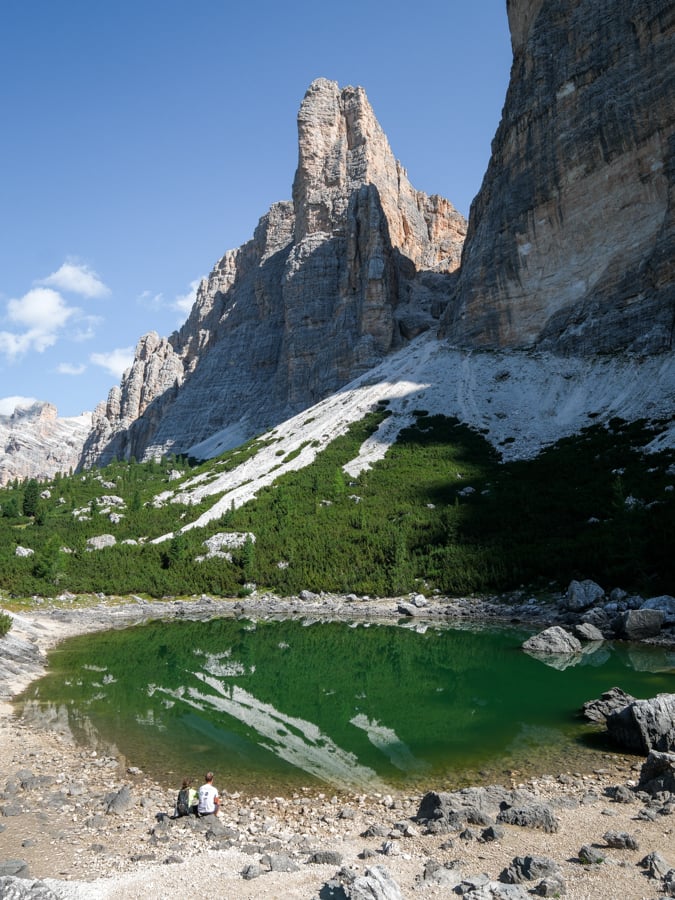
Lago di Lagazuoi
The hike to the lake is mostly uphill, but with a good pace you can reach it in about 1 hour, and going back down is a bit quicker.
There’s also a rifugio along the way, where you can get something to eat or even stay overnight.
The hike starts in Sciare, which has plenty of paid parking, and no advance booking is needed as of 2026.
Distance: 5.8 kilometers (3.6 mi) roundtrip
Elevation Gain: 465 meters (1,525 ft)
Difficulty: Moderate
Map: AllTrails
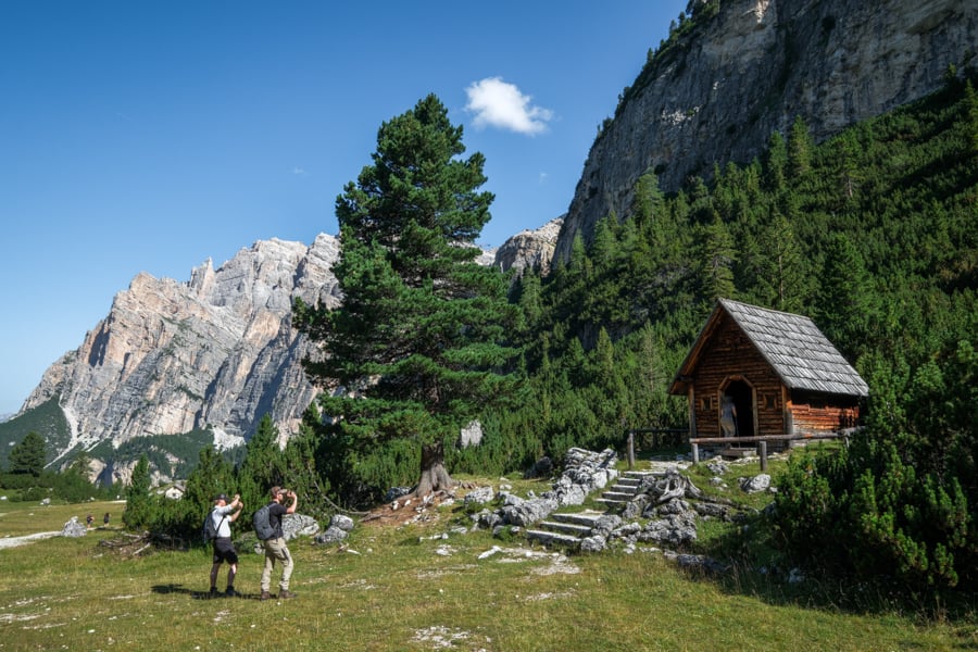
A little chapel on the way to Lago di Lagazuoi
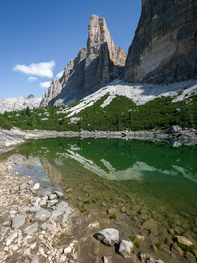
On the edge of the lake
11. Val Fiscalina
This is a flat and pleasant walk through a green valley, with wonderful views of ranches and mountain peaks.
I only followed the trail as far as the Rifugio Fondovalle / Talschlusshutte and then turned back, but the trail continues and branches off in all different directions if you want to keep going longer.
This trail even connects to Tre Cime di Lavaredo if you follow it long enough! Some people use it as a way to hike to Tre Cime from the opposite side of the mountains, giving a different perspective without quite as many people.
The stats below are just for the short hike to Rifugio Fondovalle and back, which is a common way for families to hike this trail.
Distance: 3.9 kilometers (2.4 mi) roundtrip
Elevation Gain: 60 meters (200 ft)
Difficulty: Easy
Map: AllTrails
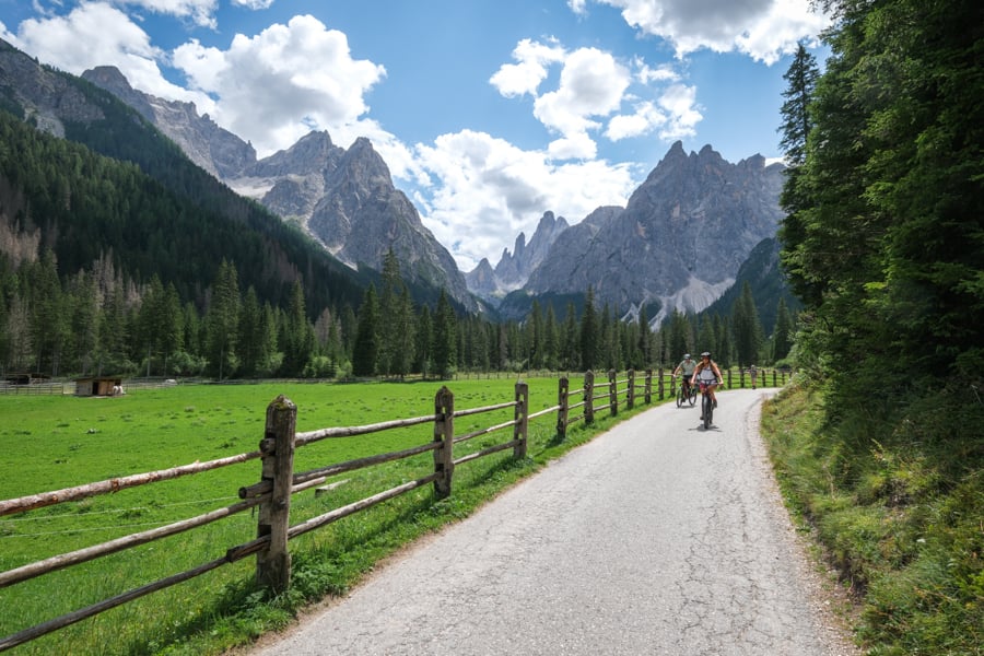
Val Fiscalina / Fischleintal
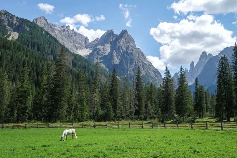
Horse in a pasture by the trail
Honorable Mentions: More Hikes In The Dolomites
• Lago di Braies Loop Trail
Lago di Braies is one of the most famous and beautiful lakes in Italy, and there’s a loop trail that goes in a circle around the lake.
This lake is very photogenic and it’s common to see pictures of it on calendars, postcards, and desktop backgrounds. You can take photos of the boats sitting on the lake before sunrise, or you can rent a boat and paddle out on the lake yourself.
The reason I haven’t listed this as one of the best hikes in the Dolomites is simply because the best views of the lake are right as you come in, and they can be seen without any hiking.
Still, the loop is a nice trail if you want to move around and see different angles of the lake!
Distance: 3.9 kilometers (2.4 mi) roundtrip
Elevation Gain: 190 meters (620 ft)
Difficulty: Easy / Moderate
Map: AllTrails
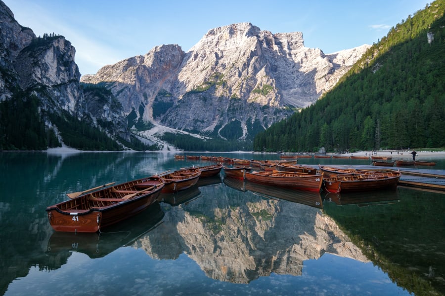
Lago di Braies at sunrise
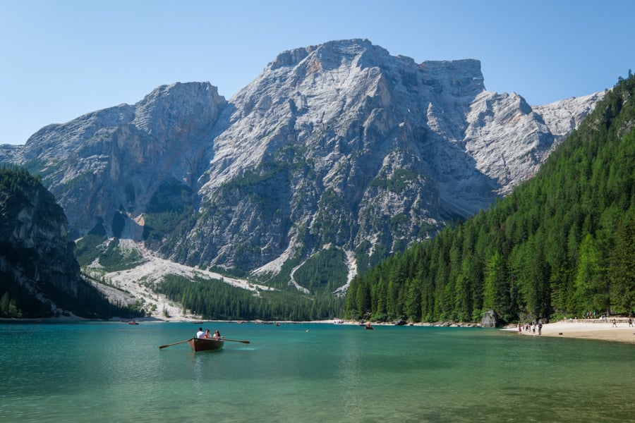
Lago di Braies at noon
• San Giacomo Church
This is the oldest church in Val Gardena, dating back to the 12th century, and it’s very photogenic thanks to the hills and mountains in the background.
The reason I haven’t listed this as one of the best hikes in the Dolomites is because most of the trail is in the forest, so you can’t really see very much along the way.
Even so, I love the view at the end of the hike, so it’s worth checking out if you’re a fan of scenic churches like this one.
Distance: 5.5 kilometers (3.4 mi) roundtrip
Elevation Gain: 340 meters (1,115 ft)
Difficulty: Moderate
Map: AllTrails
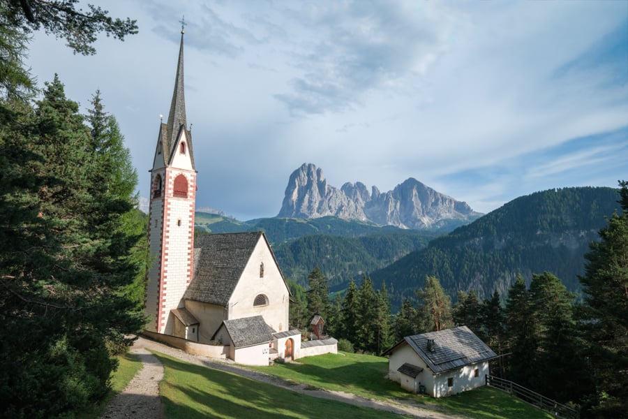
St Jacob’s Church / Chiesa di San Giacomo
• Alpe di Siusi
This is a relaxing, paved walk on a plateau with nice views of rolling hills and farmhouses, framed by the mountains behind.
There are gondolas to Alpe di Siusi from either Ortisei or Siusi, and you can buy the tickets online or in person. The official site for Ortisei tickets is here, and Siusi is here. The other option is to drive up yourself, but online reservations are required.
A lot of people rave about this place, and it’s nice, but to me it wasn’t quite on par with the other hikes we did in the Dolomites. Then again, most people recommend going at sunrise, and we didn’t, so maybe that’s partly why it was underwhelming for us.
If you don’t mind waking up early, this could be a great spot to check out!
Distance: 12.5 kilometers (7.8 mi) roundtrip
Elevation Gain: 325 meters (1,070 ft)
Difficulty: Moderate
Map: AllTrails
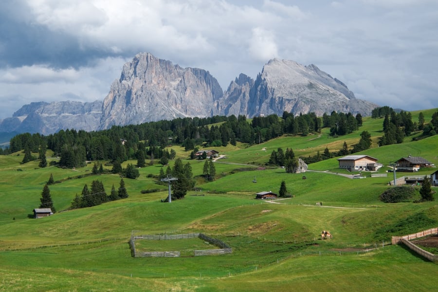
Alpe di Siusi
More Hiking Ideas For The Dolomites
Here are a few more interesting hikes in the Dolomites that are on our short list, but we didn’t have chance to do them yet:
- Lago di Antermoia – Hard hike to an impressive alpine lake.
- Tofana di Mezzo – Short hike from a cable car to the top of one of the tallest mountains in the Dolomites.
- Forcella Lagazuoi – Passo Falzarego – A point to point hike that’s mostly downhill, with high mountain views.
- Via Ferrata Bocchette Centrali – This is a scary cliffside trail where you use metal ladders, cables, and rungs, so it’s not for everyone, but the views look amazing.
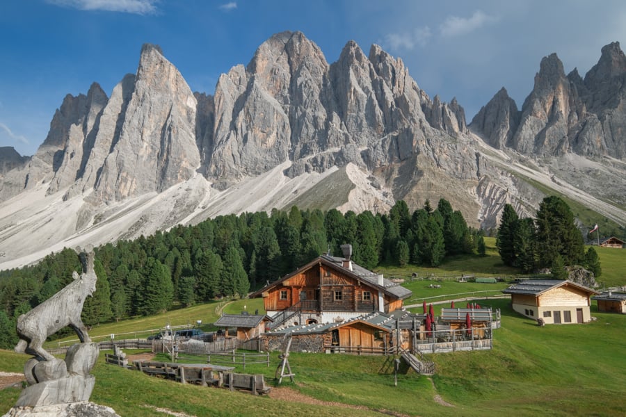
Rifugio Odle restaurant on the Adolf Munkel trail
Map Of Hikes In The Dolomites
Here’s a map of some great hikes in the Dolomites, just so you can get a general idea of where they are in the country.
Keep in mind these locations may be approximate, so it’s best to use the maps on AllTrails for exact hiking routes.
More Fun Activities To Do In North Italy
More Dolomites Guides
Thanks for looking! I hope you enjoyed this guide for the best hikes in the Dolomites.
I’ll be writing more travel guides for Italy on my blog, so don’t forget to check back later!